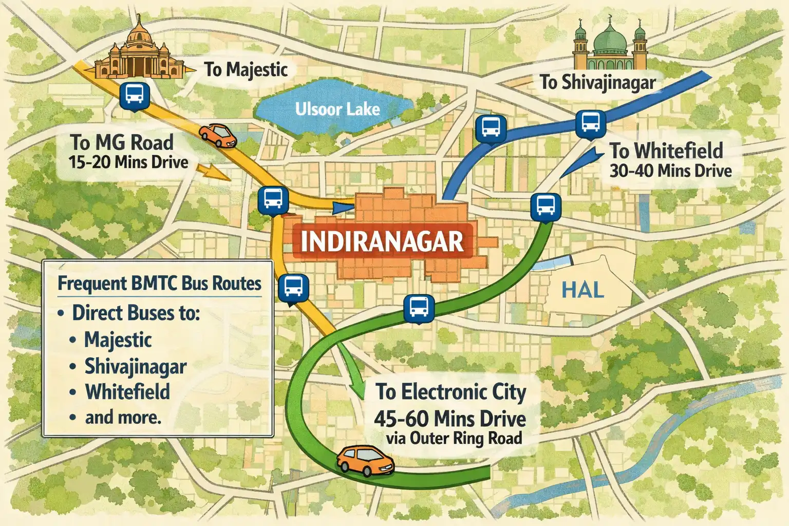
Indiranagar sits in the eastern part of Bengaluru and connects easily to most major parts of the city. Many people choose this area because it offers both convenience and lifestyle. You can reach business hubs, shopping streets, metro stations, and the airport without much struggle. The roads stay active throughout the day, yet the residential lanes feel calm and organized.
Let’s break it down clearly.
Where Exactly Is Indiranagar?
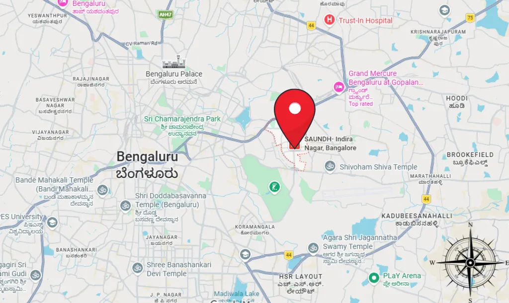
Indiranagar lies between Old Madras Road and the Inner Ring Road. It shares borders with areas like HAL, Domlur, Ulsoor, and CV Raman Nagar. This location gives it strong connectivity in almost every direction.
If you travel toward the west, you reach MG Road and the central business district. If you move east, you connect to KR Puram and Whitefield. Head south, and you reach Koramangala and HSR Layout through the Inner Ring Road. Travel north, and you move toward Ulsoor and the older parts of the city.
Because of this central positioning in East Bengaluru, many professionals prefer to live here instead of staying far from work.
Road Connectivity
Indiranagar connects through wide and well-known roads.
- 100 Feet Road acts as the main commercial spine.
- CMH Road links residential blocks to the metro station.
- Old Madras Road connects the area to KR Puram and further highways.
- Inner Ring Road connects it to Koramangala, Domlur, and Sarjapur side.
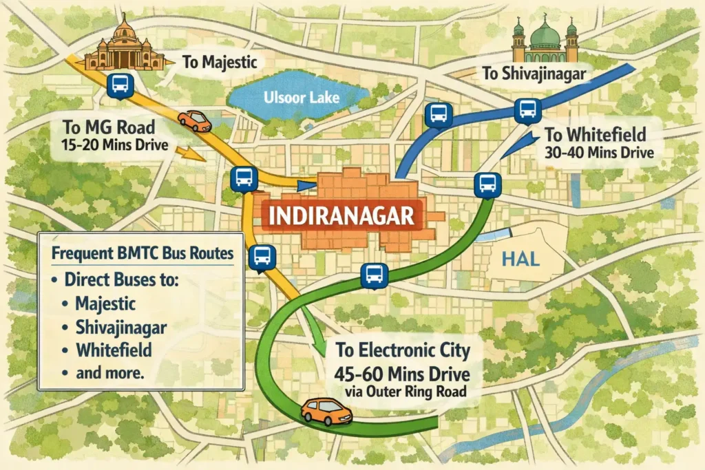
You can drive to MG Road in about 15–20 minutes during regular traffic. Whitefield usually takes 30–40 minutes, depending on peak hours. Electronic City takes longer, but the Ring Road route helps reduce city center traffic.
BMTC buses run frequently from this area. You will find direct buses to Majestic, Shivajinagar, Whitefield, and other major points. This reduces dependency on private vehicles.
For people who travel daily for work, this road network makes life easier.
Metro Connectivity
Namma Metro improved Indiranagar’s accessibility significantly. Indiranagar Metro Station falls on the Purple Line.
The Purple Line connects:
- Baiyappanahalli on one end
- MG Road and Majestic in the center
- Kengeri on the other end
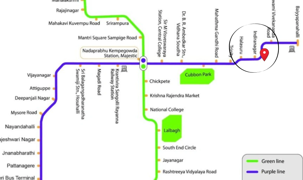
From Indiranagar Metro Station, you can reach MG Road in just two stops. Majestic, the city’s main railway and bus hub, becomes accessible without worrying about traffic jams.
Many office-goers now choose the metro because it saves time and energy. Even students and shoppers prefer it for quick city access.
Airport Connectivity- BLR Airport
Kempegowda International Airport lies about 35 to 40 kilometers from Indiranagar.
You can reach the airport in multiple ways:
- Airport taxi services
- App-based cab services
- Airport shuttle buses
- Metro connection with interchange (longer but cost-effective)
Under normal traffic conditions, the drive takes around 45 to 60 minutes via the airport road. During peak hours, travel time may increase. Still, compared to many southern parts of Bengaluru, Indiranagar offers relatively balanced airport access.
For frequent travelers, this location works well. However, if you’re looking for comfort close to the terminal, there are several hotels available near BLR Airport.
Connectivity to IT Hubs
Indiranagar stays close to major employment zones.
- HAL and Domlur business areas sit nearby.
- Whitefield IT parks remain within manageable driving distance.
- Many startups operate within Indiranagar itself.
- Koramangala and HSR Layout remain accessible through the Inner Ring Road.
Professionals working in EGL, Embassy Golf Links, or Bagmane Tech Park find the commute practical. This proximity increases rental demand and keeps property values stable.
If someone works in central Bengaluru, Indiranagar feels even more convenient.
Railway and Bus Access
Krantivira Sangolli Rayanna railway station, also known as KSR Bengaluru City Railway Station, lies about 8–10 kilometers away. You can reach it via metro or cab.
Shivajinagar Bus Stand and Majestic Bus Stand also remain accessible through metro or road. Long-distance travelers find this helpful.
Even local commute stays smooth because autos, cabs, and buses remain easily available throughout the day.
Walkability and Internal Connectivity
Inside Indiranagar, blocks follow a clear grid layout. The area divides into stages and blocks, which makes navigation simple.
Many people walk to cafes, grocery stores, gyms, and metro stations. 100 Feet Road and CMH Road support both vehicle movement and pedestrian access. Side streets remain quieter and more residential.
This mix of commercial and residential planning gives the area a balanced feel.
You do not always need a car here. That alone increases its appeal.
Why Location Matters Here
Location influences property prices, rental demand, and daily comfort. Indiranagar benefits from:
- Central eastern positioning
- Metro access
- Strong road network
- Close proximity to business districts
- Direct access to lifestyle zones
Because of this, the area attracts working professionals, entrepreneurs, and even families who want convenience without living in extreme city chaos.
The connectivity also supports retail businesses. Restaurants, boutiques, and offices perform well because customers can reach them easily.
Final Thoughts
Indiranagar’s location gives it a strong advantage in Bengaluru’s real estate and lifestyle map. It connects smoothly to the airport, metro network, IT parks, and central business districts. Roads link it in all major directions. Public transport reduces daily travel stress.
At the same time, residential blocks maintain structure and accessibility.
If you look for an area in East Bengaluru that combines connectivity with everyday comfort, Indiranagar stands out. It does not feel isolated. It does not feel too far from work hubs. And it does not demand long daily travel hours for basic needs.
That balance explains why it continues to remain one of the most preferred neighborhoods in the city.